Mountaintop mining pollution has distinct isotopic fingerprint
Three elements commonly found at elevated levels in an Appalachian river polluted by runoff from mountaintop coal mining have distinctive chemistries that can be traced back to their source, according to a Duke University-led study.
The distinctive chemistries of sulfur, carbon and strontium provide scientists with new, more accurate ways to track pollution from mountaintop mining sites and to distinguish it from contamination from other sources.
"Essentially, we found that these elements have unique isotopic fingerprints, meaning we can use them as diagnostic tools to quantify mountaintop mining's relative contribution to contamination in a watershed," said Avner Vengosh, professor of geochemistry and water quality at Duke's Nicholas School of the Environment.
The newly identified tracers will be especially useful in watersheds with more than one source of potential contamination, he said. "Because they allow us to distinguish if contaminants are coming from natural sources, fracking and shale gas development, coal mining, coal ash disposal, or other causes."
The researchers measured the chemical and isotopic compositions of water samples collected monthly from 23 locations along West Virginia's Upper Mud River and its tributaries between May and December 2012.
They found that the isotopic signatures of sulfur (in sulfate), carbon (in dissolved inorganic carbon) and strontium from water samples collected from tributaries adjacent to mountaintop mining sites are distinguishable from those collected from unaffected upstream waters. They also found that the strontium isotope ratio is a sensitive tracer for selenium contamination, one of the major pollutants of mountaintop mining.
In mountaintop mining, companies use explosives and heavy machinery to clear away surface rocks and extract shallow deposits of high-quality coal. The companies typically dispose of the waste rock in adjacent valleys, where they bury existing headwater streams.
Previous studies by the Duke team and others have shown that runoff from these "valley fills" contains elevated levels of salts and selenium, a known fish toxin. The contamination can persist and accumulate in downstream waters for decades after active mining stops and the fills are reclaimed.
By conducting tests that simulated the natural leaching of contaminants from local rocks, Vengosh and his team were able to characterize the chemistry of the different geological formations that end up as waste rock in these fills. They found significant differences in strontium isotope ratios and selenium concentrations in streams flowing from reclaimed valley fills versus those flowing from active fills.
"This helps us further pinpoint the source of contamination by linking it directly to the type of rocks in the valley fills," Vengosh said.
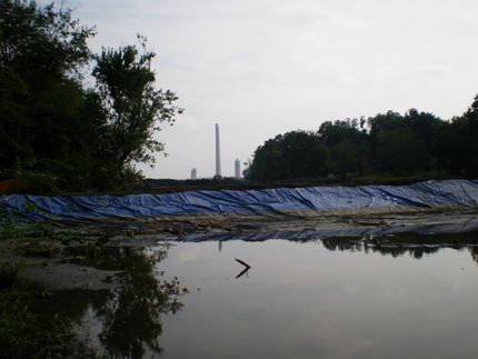
The Upper Mud River flows through sparsely populated areas of southern West Virginia as a headwater stream. For about 10 kilometers, the river passes through the Hobet 21 surface mining complex, which has been active since the 1970s and is among the largest in the Appalachian coalfields.
Original publication
Other news from the department science

Get the chemical industry in your inbox
By submitting this form you agree that LUMITOS AG will send you the newsletter(s) selected above by email. Your data will not be passed on to third parties. Your data will be stored and processed in accordance with our data protection regulations. LUMITOS may contact you by email for the purpose of advertising or market and opinion surveys. You can revoke your consent at any time without giving reasons to LUMITOS AG, Ernst-Augustin-Str. 2, 12489 Berlin, Germany or by e-mail at revoke@lumitos.com with effect for the future. In addition, each email contains a link to unsubscribe from the corresponding newsletter.


